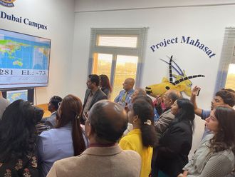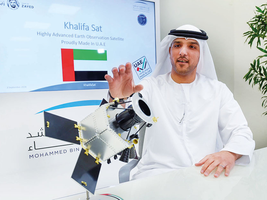
Dubai: The KhalifaSat, the first 100 per cent Emirati designed and built satellite, is ready to be shipped to Japan for its launch on October 29 at 8.08am, UAE time.
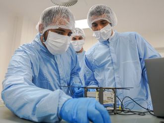
Ten engineers from the Mohammad Bin Rashid Space Centre (MBRSC) will be flying to Japan 40 days before the launch to oversee the final tests and preparation of the first satellite manufactured on UAE soil, Amer Al Sayegh, KhalifaSat project manager at MBRSC, said.
“This is one of the biggest achievements for the UAE to be able to develop a satellite locally by UAE nationals. This is one of the best satellites in the world when it comes to remote sensing and earth observation,” Al Sayegh said on Monday.
KhalifaSat is a highly advanced earth observation satellite that will orbit the earth from pole to pole at a distance of 613km.
Five patents were written under the KhalifaSat, including its camera that is able to produce an image with a 70cm ground sample distance (GSD). Meaning, each pixel of the image represents 70cm of the ground being captured.
This is a far cry from DubaiSat-1’s capability of 2.5 metres per pixel and DubaiSat-2’s 1-metre per pixel GSD.
“The satellite will capture an image from a height of 613km. If you put that in the ground, every pixel represents 70cm, which means you can identify objects that are this big [70cm] as viewed from the satellite. You can identify objects like cars, planes, roads,” Al Sayegh said.
The high-resolution imagery and high accuracy is useful for one of the satellite’s applications, which is cartography or map making. Every six months, it will provide a mosaic image of the emirate or the country to the Dubai Government.
Al Sayegh said MBRSC has been working with its partners in Japan for the past two years to pave the way for a successful launch.
The actual launch where the rocket leaves Earth and reaches space will take 15 to 20 minutes. MBRSC will then have to wait another two hours to confirm successful separation and operation of the satellite.
Al Sayegh emphasised that the point of attachment of the satellite to the Mitsubishi Heavy Industries rocket — H-IIA — launcher is the most critical point before the launch.
“Below the satellite is tonnes of fuel and anything can go wrong. The satellite must also be able to withstand the vibrations during launch. This is why we are working with our Japanese partners to ensure that KhalifaSat is delivered successfully into space. We will ensure no valves get lost, no telemetry goes wrong, no fuel goes outside and so forth,” he said, adding the satellite is fully insured.
Al Sayegh declined to comment on the cost of manufacturing and launching KhalifaSat, emphasising that the investment is “directed and achieved by seeing the infrastructure development, and by seeing UAE nationals and scientists [achieving the UAE’s space sector objectives] that will serve humanity”.
Al Sayegh, however, said that the total project cost is similar to that of a typical average satellite.
Al Sayegh said the KhalifaSat gave the UAE the global recognition as a space centre leading the space industry in the region. It might also pave the way for future launches in the UAE.
“At the moment we don’t have any initiative on launching satellites from the UAE. But there are no limits to the ambitions of the UAE. We are sure that it is going to happen. The UAE never says ‘no’ to new achievements and advances in science and technology.”
All you need to know
When will KhalifaSat be launched?
It will be launched on October 29 at 8.08am (UAE time) from the Yoshinobu Launch Complex at the JAXA Tanegashima Space Centre, an island to the south of Japan.
The launch vehicle is an H-IIA.
Can you watch the launch?
The launch will be live streamed on MBRSC’s YouTube channel. There will also be social media live coverage and live broadcast on TV channels.
What are KhalifaSat’s specifications?
It will orbit Earth at a distance of 613km, pole to pole. It weighs roughly 330kg and measures 2 metres by 1.5 metres. It has a lifespan of five years.
Who manufactured KhalifaSat?
70 Emirati engineers, including fresh graduates, worked on the satellite at MBRSC.
What are the five patents under KhalifaSat?
Camera: It is able to produce an image with a 70cm ground sample distance.
Advanced storage and download capability: This means the satellite will be able to take more images and download them at a faster time.
Advanced Positional System: This determines where the satellite takes the images.
Improved autonomous operation. In case something goes wrong, the satellite in a smart way, will be able to handle any issues and respond to any requests from the ground station.
Actual improvement on the ground system.
What are the uses of KhalifaSat’s images?
Satellite imagery captured with a resolution of 70cm to all UAE Government entities and universities. Commercial use may be determined later as per the centre’s policy.
It can provide environmental studies including detecting oil spills on land, monitoring land contamination, water quality and water resources monitoring.
It can also provide support in disaster management.