Dubai: The Google Maps Street View feature can now be used in Sharjah and Ajman, adding both emirates to a list of 3,000 cities around the world that have this option.
Designed to allow users to view and navigate 360 degree street-level imagery of major streets across both emirates, the Street View feature is an advantage not only for tourists but for residents and businesses too.
“The idea behind the feature is to create a digital mirror of the world not only through imagery but by navigation,” Joyce Baz, Communications Manager at Google Mena, told Gulf News.
Users are able to explore landmarks, view natural wonders, and navigate a trip or other points of interest. All streets across both Sharjah and Ajman can be viewed through the new feature, giving residents the chance to view specific streets or buildings in the emirate before visiting them.
Baz explained the feature is also an advantage for businesses that can increase exposure by embedding the 3D map on to their website.
Tourists can also preview popular spots in Dubai, Sharjah and Ajman before planning a visit to the UAE. “Users have the chance to discover places and explore new areas they might not be able to visit easily simply through their desktops or smartphones,” said Baz.
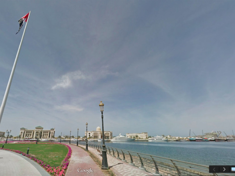
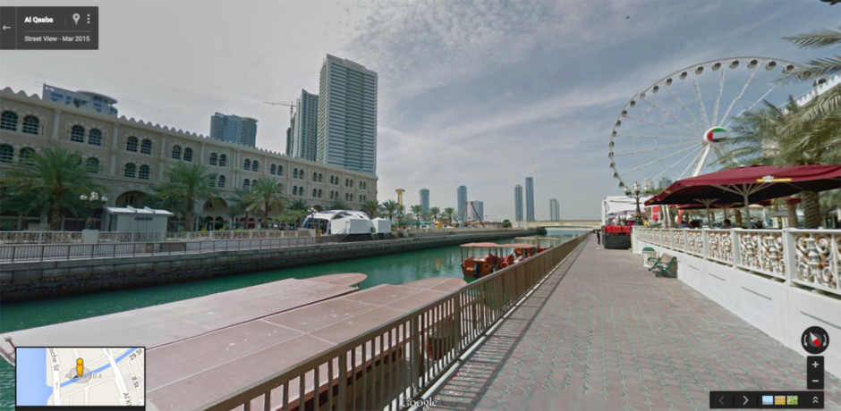
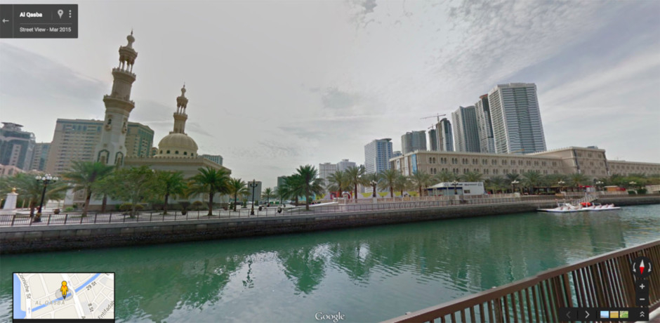
Some of the popular areas in Sharjah captured by Street View are Al Noor Mosque, the Khor Fakkan and Kalba enclaves on the East Coast, the Al Tamal camel track, and the Al Murabaa watchtower on the Corniche. The feature also takes users down footpaths, tracks and narrow pathways to get images of natural beauty spots and tourist sites — some of which include Al Majaz Waterfront along with Al Qasba and the Ferris wheel.
Streets including Al Khan, Al Wahda and Corniche in Sharjah, and Al Muntazah Street, Shaikh Rashid Bin Humeed, Shaikh Khalifa Bin Zayed and Shaikh Ammar Bin Humaid street in Ajman are also among the popular streets that can be viewed on the new feature.
“More than 10,000 updates of road addresses, business addresses, and street photos from around the world take place on the app every day,” said Baz.
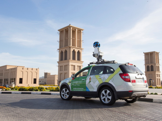
The Street View imagery on the app is gathered by a vehicle equipped with advanced imaging technology, which includes a camera mounted on the roof of a car that collects imagery and location data. After collection, the imagery is stitched together to create the 360 degree panoramic images that allow you to move around and explore locations as if you were there.
Google Street View imagery was first launched in May 2007 and is already available across 63 countries. The first Street View Special Collect in the UAE was launched in 2013 for Burj Khalifa followed by the Shaikh Zayed Grand Mosque Centre and the Liwa desert in Abu Dhabi. In 2014, Dubai was the first Arab city to have Street View on a street level. While future plans include launching the same feature in Abu Dhabi, nothing is confirmed yet.