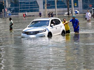
Dubai: A project to affix location coordinate plates to buildings in Dubai that will allow residents to accurately inform authorities, taxis or guests of their precise location will begin in the first quarter of 2015, a senior official said.
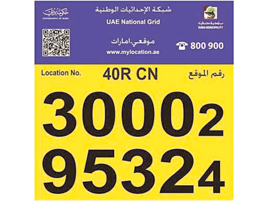
The new Makani satellite address system introduced by Dubai Municipality is accurate down to a metre and even shows the location of a building’s different entrances on smartphones and GPS devices.
Currently most people rely on nearby landmarks or major roads to describe their location or address.
Pending final approval from higher authorities, the municipality will start installing the plates early next year in around 120,000 buildings, said Abdul Hakim Abdul Kareem Malek, director of Geographic Information System at Dubai Municipality.
“We will start in phases — in important places first. It will include freezones and Hatta area. This will become the official geo address system of Dubai, everyone will start using it,” Malek told Gulf News on Wednesday.
The plates will display the location’s unique Makani 10-digit code generated by satellite. The code can be shared with emergency services or friends on the free Makani app to enable the receiver to view — and be guided to — the exact location.
“Even foreigners or visitors who don’t know the name or right pronunciation of the place can let people know of their location using purely [Makani] numbers, which are part of a satellite coordination system. There will be no problems with addresses,” Malek said.
Makani will make it fast, easy and accurate to report incidents and crimes, he said.
Malek added that other location tracking services using the 3G network “don’t always give exact locations” as their accuracy depends on the proximity and availability of communication towers.
He said the Makani system, relying on satellites, also works independently from the GPS system.
The app is available in all versions of different devices, such as smart phones (iPhone, Android, BlackBerry) and tablet PCs, computers and navigational devices in cars.
It can be downloaded for free from AppStore (iPhone) and GooglePlay (Android).
In the future, Malek said, there is a plan to integrate other services with Makani, such as displaying the location’s contact information, services and nearby facilities, possibly using Augmented Reality features on smartphones.
Makani coordinates may also be converted to formats used on other location tracking systems such as DMS (Degree, Minutes, Seconds) and Latitude-Longitude within the app itself.