London: Imagine if the terms of the UK’s impending departure from the European Union were negotiated in just a month.
No two-year exit discussions, no post-Brexit transitional period — just an almost overnight withdrawal from the bloc and all the confusion that would cause.
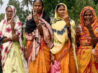
Then throw in civil war, religious fanaticism, mass migration, violence and death. Then, according to historian Professor Joya Chatterji, you can start to appreciate just how chaotic the partition of India in 1947 was.
“When I woke up on the morning after the Brexit vote, I thought ‘this is partition’. And it is, except it’s taking endless years. In India it took a month,” said the professor of South Asian history at Cambridge University.
“It’s like having a cack-handed, sloppy, hard, extreme Brexit done in a month. No careful, negotiated Brexit that tried to figure out what was in the best interests of the people that have to live through this.
“They [the British in India] just didn’t bother to take the time to do it in that careful way.”
As it became apparent that India would be divided in the wake of independence, British Viceroy Lord Mountbatten was eyeing a rapid exit and the date of transfer was set for August 1947. In July, he brought in a lawyer named Cyril Radcliffe to oversee the partition of the two huge states that were to be divided — Punjab in the west and Bengal in the east.
Radcliffe had no experience of adjudicating in such matters, he had never been to the subcontinent before, had no time to survey the new boundary areas, and was under intense political pressure. Yet it was his responsibility to draw the so-called Radcliffe Line in just five weeks.
The result was a badly thought out and impractical boundary that added to the confusion rather than end it, and which also created many controversies — some of which remain unresolved today, 70 years later.
“The rule of thumb was that the line had to follow contiguous Muslim majority districts, but there was this clause that other factors could be taken into consideration. That became an area of great controversy — what was a good enough other factor?” said Professor Chatterji, the author of Bengal Divided and The Spoils of Partition.
“A huge number of problems arose. One issue is that Radcliffe tried to use natural frontiers where he could. As an Englishman, he must have thought ‘well natural frontiers are natural frontiers’, but never having been to the subcontinent he didn’t really get that rivers are not natural frontiers in that they dramatically shift their course every five years or so with a major monsoon.
“So he tried to use branches of the Indus in West Pakistan and the Ganges in East Pakistan as his natural frontiers. But from the maps he was using, the actual rivers had moved on the ground. This created Alice in Wonderland areas — where is the real boundary? Is it where Radcliffe drew on the map or is it the river?
“My own view is that no boundary, however carefully drawn, would ever have avoided all the mayhem. But some of the mayhem could have been foreseen and avoided. It could have been done better, but that’s not necessarily Radcliffe’s fault because I think he did the best he could with the materials that he had at hand.”
Although Radcliffe met his deadline of August 12th, his report wasn’t published until the 17th — after independence had been declared — which only compounded the errors.
“It was certainly a shocking, shocking story,” said Professor Chatterji. “And what was more remarkable was that, after the retreat from India, the British then used the partition as a model, as a good thing to apply to retreats in other parts of the world, such as in 1948 Palestine — with interesting legacies.
“They continue to bring up this model — talking about the partition of Iraq, possible partition of Syria — as though it works. It did not work, it was a disaster, it was a human catastrophe.”
- The writer is a freelance journalist based in the UK