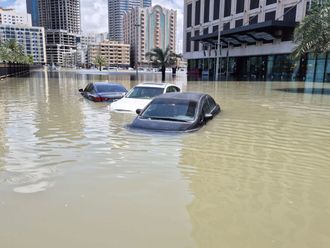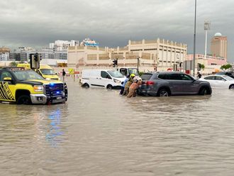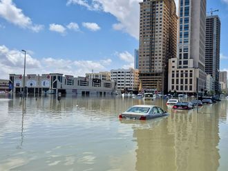
Abu Dhabi: Recent projects in Abu Dhabi such as the installation of more speed cameras to streamline the traffic situation may enable the surveillance of all streets in the city limits but may not serve as a reliable tool in case of an emergency or a crisis.
During a recent workshop on the need for developing and defining geospatial capabilities necessary to create better emergency and crises safeguards in the UAE, Commodore Pat Tyrrell, Deputy Chief Executive at the Defence Communication Services Agency in the UK, spoke about how geospatial intelligence (storing and processing location information in a database) can be used by the emergency management and civil defence sectors to help safeguard national security.
"The use of crisis geospatial intelligence was only used by the military, but it is now available for everyone, since decision-makers are starting to realise that it can be used to identify important environmental, safety, and transport concerns.
Integration of systems
"In Abu Dhabi for instance, cameras on the road must be incorporated by proper data to help respond to crimes, emergencies, and accidents in a more timely manner," Commodore Tyrrell told Gulf News.
Making use of space and airborne terrestrial systems alongside the proper integrated data will help bring about a coherent picture on how things look like in the streets of Abu Dhabi. "The whole point is to enable different entities to use their resources effectively," added Tyrrell.
Apart from latest technology and developments in the geospatial systems, key regional speakers are due to share their ideas in the next two days, on how a geographic information system (GIS), can help ensure national security in the UAE — through efficient collaboration between the key defence, intelligence, emergency management and crisis response bodies.